Field stations

Field Station Property Data

Acreage: 9.2
Buildings: none
Road Access:
drive in with limited parking
Shoreline Change: very low to low erosion
Topography: wooded and saltmarsh/low marsh
Shoreline Type: non-structural living shoreline
Virginia Coastal Master Plan: https://crmp-vdcr.hub.arcgis.com/maps/84a4a7f24e4a4ee9ab6417585de302b9/explore?location=37.440555%2C-76.671111%2C16.00
PAA Link: https://mppaa.virginiainteractive.org/Item/Detail/92
Coordinates: 37°19’30.8″N 76°25’42.9″W

Acreage: 21 (2 parcels)
Buildings: homesite on parcel one
Road Access:
on road
Shoreline Change: medium to high erosion
Topography: upland wooded and forested marshland
Shoreline Type: none
Virginia Coastal Master Plan: https://crmp-vdcr.hub.arcgis.com/maps/84a4a7f24e4a4ee9ab6417585de302b9/explore?location=37.405055%2C-76.262000%2C16.00
PAA Link:
Coordinates: 37°24’18.2″N 76°15’43.2″W

Acreage: 265 (3 parcels)
Buildings:
Road Access:
parking
Shoreline Change: no data
Topography:
Shoreline Type: none
Virginia Coastal Master Plan: https://crmp-vdcr.hub.arcgis.com/maps/84a4a7f24e4a4ee9ab6417585de302b9/explore?location=37.781638%2C-76.789361%2C16.00
PAA Link: https://mppaa.virginiainteractive.org/Item/Detail/45
Coordinates: 37°46’53.9″N 76°47’21.7″W

Acreage: 0.61
Buildings:
Road Access:

Shoreline Change: low to medium erosion
Topography: tidal wetlands and pine upland
Shoreline Type:
Virginia Coastal Master Plan: https://crmp-vdcr.hub.arcgis.com/maps/84a4a7f24e4a4ee9ab6417585de302b9/explore?location=37.267277%2C-76.415444%2C16.00
PAA Link:
Coordinates: 37°16’02.2″N 76°24’55.6″W

Acreage: 96.81
Buildings: main house (two well connections), pool house (one well connection), white shed, 2 barns (one with connection to well), 3 water wells, and two drainage fields
Road Access:
parking
Shoreline Change: low erosion
Topography: Estuarine and marine wetland, freshwater emergent wetland, freshwater forested/shrub wetland, tidal, non-vegetated wetlands
Shoreline Type:
Virginia Coastal Master Plan: https://crmp-vdcr.hub.arcgis.com/maps/84a4a7f24e4a4ee9ab6417585de302b9/explore?location=37.327878%2C-76.425024%2C16.00
PAA Link: https://mppaa.virginiainteractive.org/Item/Detail/77
Coordinates: 37°19’30.8″N 76°25’42.9″W

Acreage: 25.58
Buildings:
Road Access:

Shoreline Change: Medium and low erosion to the east and low to very low erosion to the south (no direct shoreline)
Topography: tidal marsh
Shoreline Type:
Virginia Coastal Master Plan: https://crmp-vdcr.hub.arcgis.com/maps/84a4a7f24e4a4ee9ab6417585de302b9/explore?location=37.327878%2C-76.425024%2C16.00
PAA Link:
Coordinates: 37°19’30.8″N 76°25’42.9″W

Acreage: 29.3
Buildings: two barns
Road Access:

Shoreline Change: no data
Topography: marsh/swamp, forested wetland
Shoreline Type: none
Virginia Coastal Master Plan: https://crmp-vdcr.hub.arcgis.com/maps/84a4a7f24e4a4ee9ab6417585de302b9/explore?location=37.876621%2C-76.891188%2C15.00
PAA Link:
Coordinates: 37°52’27.4″N 76°54’10.6″W

Acreage:
Buildings:
Road Access:

Shoreline Change: low/very low erosion
Topography: tidal marsh
Shoreline Type:
Virginia Coastal Master Plan: https://crmp-vdcr.hub.arcgis.com/maps/84a4a7f24e4a4ee9ab6417585de302b9/explore?location=37.327878%2C-76.425024%2C16.00
PAA Link:
Coordinates: 37°19’30.8″N 76°25’42.9″W

Acreage: 5.25
Buildings:
Road Access:
walk-in and water access only
Shoreline Change: very low to medium erosion
Topography: tidal marsh and upland wooded area
Shoreline Type:
Virginia Coastal Master Plan: https://crmp-vdcr.hub.arcgis.com/maps/84a4a7f24e4a4ee9ab6417585de302b9/explore?location=37.331221%2C-76.300459%2C16.00
PAA Link: https://mppaa.virginiainteractive.org/Item/Detail/85
Coordinates: 37°19’51.2″N 76°18’20.5″W

Acreage: 188.5 acres total 4 islands – 90 acres, 13.5 acres, 10 acres, 43 acres, and 32 acres
Buildings:
Road Access:
boat access only
Shoreline Change: outside of boundary of data (closest is low and very low erosion levels)
Topography: saltmarsh and low marsh, wetlands
Shoreline Type:
Virginia Coastal Master Plan: https://crmp-vdcr.hub.arcgis.com/maps/84a4a7f24e4a4ee9ab6417585de302b9/explore?location=37.269221%2C-76.363444%2C15.00
PAA Link: https://mppaa.virginiainteractive.org/Item/Detail/102
Coordinates: 37°16’09.2″N 76°21’48.4″W

Acreage:
Buildings:
Road Access:

Shoreline Change:
Topography:
Shoreline Type:
Virginia Coastal Master Plan:
PAA Link:
Coordinates:

Acreage: 264.87 and 184.81
Buildings:
Road Access:

Shoreline Change: no data
Topography:
Shoreline Type:
Virginia Coastal Master Plan: https://crmp-vdcr.hub.arcgis.com/maps/84a4a7f24e4a4ee9ab6417585de302b9/explore?location=37.598498%2C-76.673722%2C15.00
PAA Link:
Coordinates: 37°35’54.6″N 76°40’25.4″W

Acreage: 8.86
Buildings:
Road Access:

Shoreline Change: very low erosion
Topography: wooded
Shoreline Type:
Virginia Coastal Master Plan: https://crmp-vdcr.hub.arcgis.com/maps/84a4a7f24e4a4ee9ab6417585de302b9/explore?location=37.538916%2C-76.380590%2C16.00
PAA Link:
Coordinates: 37°32’30.0″N 76°22’46.1″W

Acreage: 2.5
Buildings: none
Road Access:

Shoreline Change: low erosion and low accertation
Topography: upland wooded area, beach, reed grass
Shoreline Type:
Virginia Coastal Master Plan: https://crmp-vdcr.hub.arcgis.com/maps/84a4a7f24e4a4ee9ab6417585de302b9/explore?location=37.266101%2C-76.392614%2C15.97
PAA Link:
Coordinates: 37°15’58.1″N 76°23’32.8″W

Acreage: 3 parcels – 5.86, 3.67, 4.38
Buildings: homesite
Road Access:
road access
Shoreline Change: no data
Topography: forested wetland, scrub-shrub wetland, wooded
Shoreline Type: none
Virginia Coastal Master Plan: https://crmp-vdcr.hub.arcgis.com/maps/84a4a7f24e4a4ee9ab6417585de302b9/explore?location=37.292189%2C-76.406447%2C16.00
PAA Link:
Coordinates: 10204 Margaret Lyell Rd, Hayes, VA 23072

Acreage: two parcels each less than an acre
Buildings:
Road Access:

Shoreline Change: low erosion
Topography: wetlands (undefined)
Shoreline Type:
Virginia Coastal Master Plan: https://crmp-vdcr.hub.arcgis.com/maps/84a4a7f24e4a4ee9ab6417585de302b9/explore?location=37.327878%2C-76.425024%2C16.00
PAA Link:
Coordinates: 37°19’30.8″N 76°25’42.9″W

Acreage: 8
Buildings:
Road Access:

Shoreline Change:
Topography:
Shoreline Type:
Virginia Coastal Master Plan:
PAA Link:
Coordinates:

Acreage:
Buildings:
Road Access:

Shoreline Change: low erosion
Topography: wetlands (undefined)
Shoreline Type:
Virginia Coastal Master Plan: https://crmp-vdcr.hub.arcgis.com/maps/84a4a7f24e4a4ee9ab6417585de302b9/explore?location=37.327878%2C-76.425024%2C16.00
PAA Link:
Coordinates: 37°19’30.8″N 76°25’42.9″W

Acreage: 320 ft
Buildings: boat launch and restrooms
Road Access:
parking
Shoreline Change: No data on erosion within wharf area, closest data suggests very low-medium erosion
Topography: saltmarsh and low marsh
Shoreline Type: marina
Virginia Coastal Master Plan: https://crmp-vdcr.hub.arcgis.com/maps/84a4a7f24e4a4ee9ab6417585de302b9/explore?location=37.266890%2C-76.423034%2C16.00
PAA Link: https://mppaa.virginiainteractive.org/Item/Detail/5
Coordinates: 37°16’06.7″N 76°25’28.7″W

Acreage:
Buildings: boat launch
Road Access:
road access
Shoreline Change: very low erosion and very low accertation
Topography:
Shoreline Type: riprap
Virginia Coastal Master Plan: https://crmp-vdcr.hub.arcgis.com/maps/84a4a7f24e4a4ee9ab6417585de302b9/explore?location=37.927948%2C-76.860622%2C16.00
PAA Link:
Coordinates: 37°55’46.5″N 76°51’24.7″W

Acreage: 14
Buildings:
Road Access:
primary access is by water but can be accessed through poorly maintained logging road
Shoreline Change: No direct data, very low/low erosion and accretion nearby
Topography: pine plantation and wetland
Shoreline Type: non-structural living shoreline
Virginia Coastal Master Plan: https://crmp-vdcr.hub.arcgis.com/maps/84a4a7f24e4a4ee9ab6417585de302b9/explore?location=37.297888%2C-76.464512%2C16.00
PAA Link: https://mppaa.virginiainteractive.org/Item/Detail/6
Coordinates: 37°17’55.1″N 76°27’43.0″W

Acreage: 1.728
Buildings:
Road Access:

Shoreline Change: very low erosion
Topography: scrub-shrub
Shoreline Type: non-structural living shoreline
Virginia Coastal Master Plan: https://crmp-vdcr.hub.arcgis.com/maps/84a4a7f24e4a4ee9ab6417585de302b9/explore?location=37.350407%2C-76.320628%2C16.00
PAA Link: https://mppaa.virginiainteractive.org/Item/Detail/86
Coordinates: 37°21’07.9″N 76°19’07.1″W

Acreage: 6
Buildings:
Road Access:

Shoreline Change: no data
Topography: tidal marsh
Shoreline Type:
Virginia Coastal Master Plan: https://crmp-vdcr.hub.arcgis.com/maps/84a4a7f24e4a4ee9ab6417585de302b9/explore?location=37.294611%2C-76.405556%2C16.00
PAA Link: https://mppaa.virginiainteractive.org/Item/Detail/104
Coordinates: 37°17’40.6″N 76°24’20.0″W

Acreage: several parcels – 12.13, 11.94, 4, 1.5
Buildings:
Road Access:

Shoreline Change: very low to medium erosion
Topography: tidal marsh, upland wooded area, forested wetland
Shoreline Type:
Virginia Coastal Master Plan: https://crmp-vdcr.hub.arcgis.com/maps/84a4a7f24e4a4ee9ab6417585de302b9/explore?location=37.372555%2C-76.358333%2C16.00
PAA Link:
Coordinates: 37°22’21.2″N 76°21’30.0″W

Acreage: 3.75
Buildings:
Road Access:
road access
Shoreline Change: low accertation and very low erosion
Topography: tidal marsh
Shoreline Type: riprap
Virginia Coastal Master Plan: https://crmp-vdcr.hub.arcgis.com/maps/84a4a7f24e4a4ee9ab6417585de302b9/explore?location=37.403333%2C-76.346083%2C16.00
PAA Link:
Coordinates: 37°24’12.0″N 76°20’45.9″W

Acreage: 9
Buildings:
Road Access:
parking
Shoreline Change: No erosion data directly on the property
Topography: upland wooded area
Shoreline Type:
Virginia Coastal Master Plan: https://crmp-vdcr.hub.arcgis.com/maps/84a4a7f24e4a4ee9ab6417585de302b9/explore?location=37.391576%2C-76.273469%2C14.00
PAA Link: https://mppaa.virginiainteractive.org/Item/Detail/89
Coordinates: 37°24’20.2″N 76°15’39.5″W

Acreage: 5
Buildings:
Road Access:
water access only
Shoreline Change: No erosion data directly on the property
Topography: upland wooded area and tidal marsh
Shoreline Type: non-structural living shoreline
Virginia Coastal Master Plan: https://crmp-vdcr.hub.arcgis.com/maps/84a4a7f24e4a4ee9ab6417585de302b9/explore?location=37.391576%2C-76.273469%2C14.00
PAA Link: https://mppaa.virginiainteractive.org/Item/Detail/88
Coordinates: 37°23’16.1″N 76°16’07.8″W

Multi-use Public Land Access

The Middle Peninsula Chesapeake Bay Public Access Authority (MP-PAA) offers access to public waters and recreational lands. Shorelines are high-priority natural areas and it is critical to set aside access sites for all types of recreational activities important to our economy and to the citizens of the Commonwealth of Virginia. These MP-PAA properties can be reserved online for outdoor recreational activities like hunting, hiking nature trails, fishing, crabbing, boating, and many others. Be mindful of users engaged in these activities while conducting research at any of the sites.

Scroll to Top
Dan Knott

Knott Alone - Hold Fast

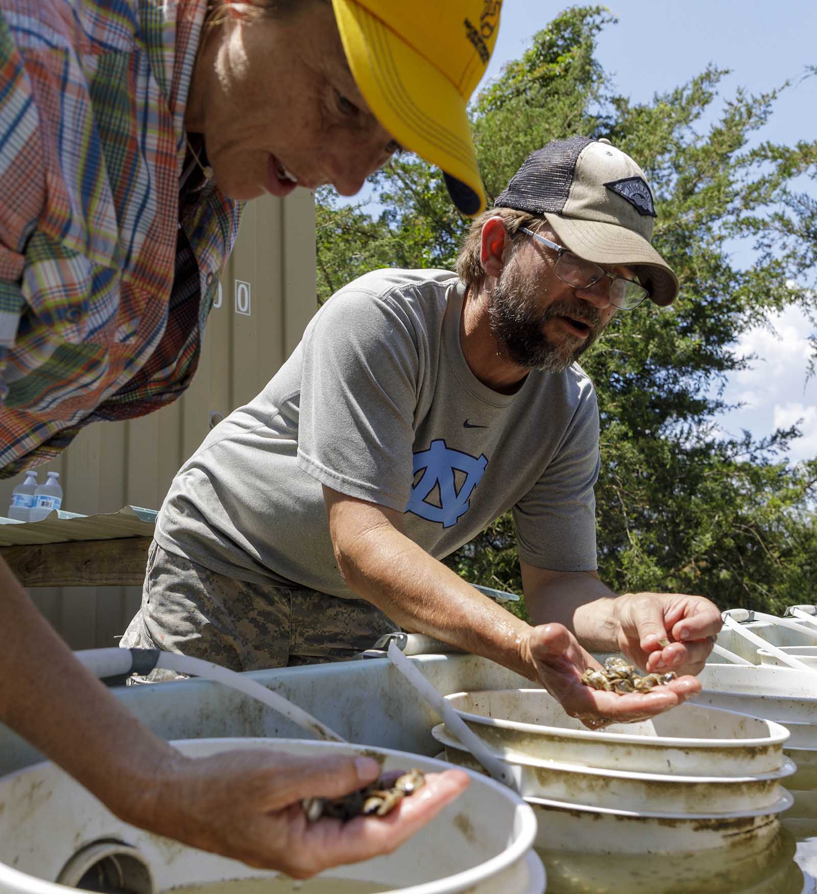
Knott Alone – Hold Fast is a nonprofit with 501(c)3 status, founded in 2021 to support veterans battling effects from military service while helping prevent suicide through hands-on commercial fishing activities combined with integrative therapy. Initial activities included only crabbing and oystering, but to ensure greater opportunity for veterans and year-round operations, Knott Alone – Hold Fast expanded into the field of living shoreline development. Knott Alone – Hold Fast’s living shoreline program provides great potential for involvement from the veteran community and is an excellent venue for broader education to communities located throughout Virginia’s Middle Peninsula Region. Additionally, the program includes workforce development opportunities to provide a pathway for advanced skill development and entrance into the workforce.

Project Goals

  • Capitalize on currently available vegetation while developing sustainable harvest techniques that will prevent overcrowding on existing areas, clear debris from wetlands to promote new growth, help monitor existing wetlands to control unwanted vegetation, and provide a supply of regionally sourced, native vegetation.
  • Establish minimally invasive farming/propagation techniques that are complementary to existing or planned coastal protective structures.

Photo Captions:

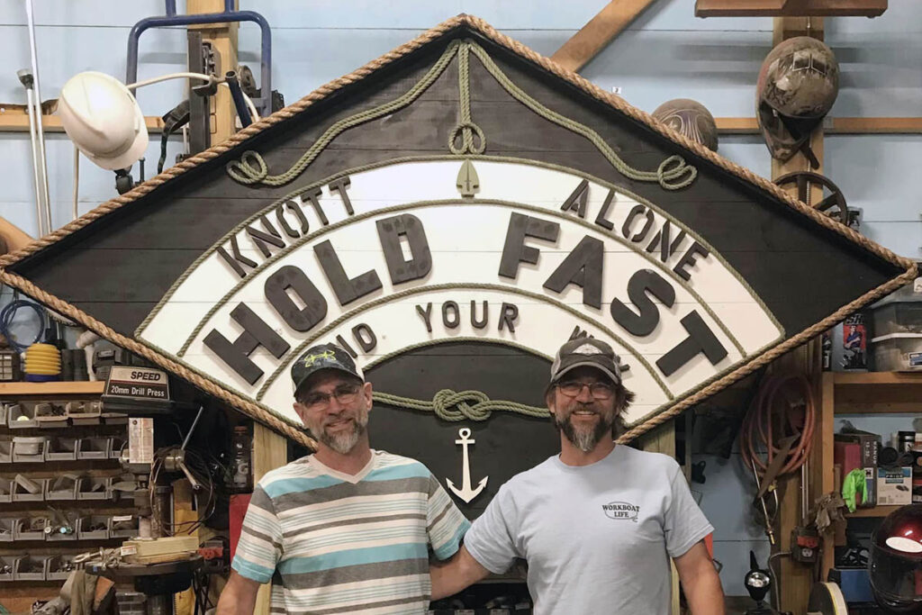
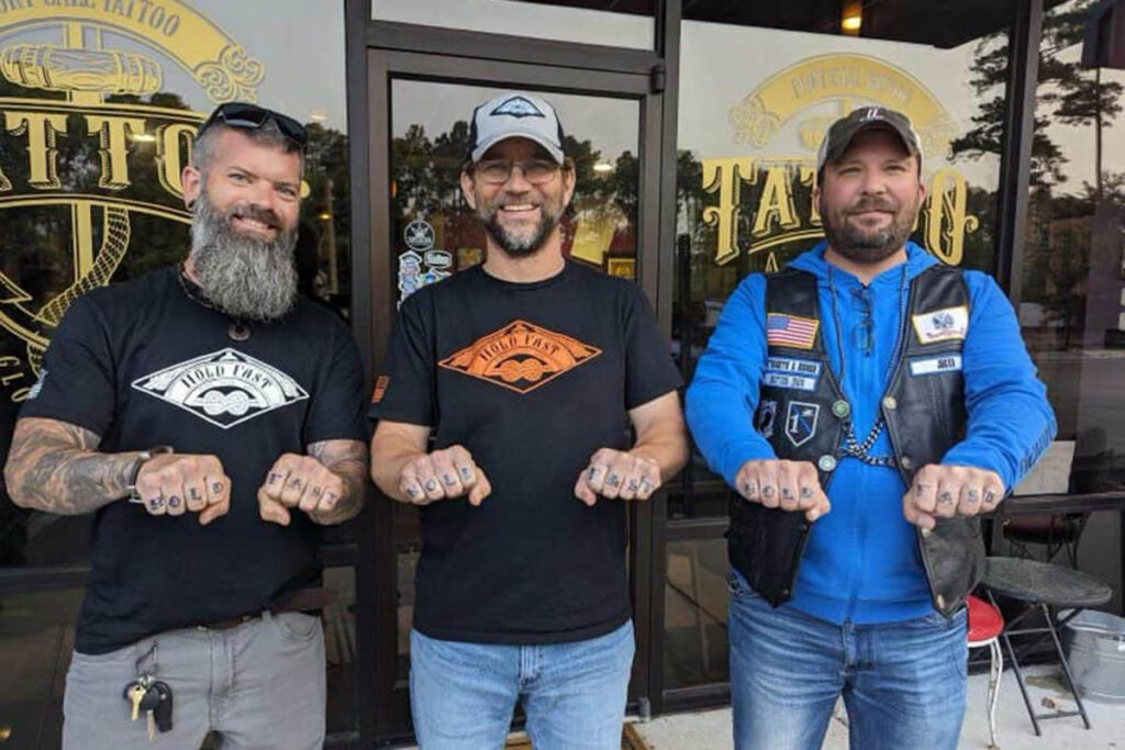
Far Left: Dan Knott, founder of Knott Alone – Hold Fast, examines cultured oysters with professor Patrice Ludwig. Top Center: Dan’s brother Frank (left) created a sign for the Whittaker Creek property. Bottom Center: Dan shows off some new tattoos with friends.

Top: Dan Knott, founder of Knott Alone – Hold Fast, examines cultured oysters with professor Patrice Ludwig. Middle: Dan’s brother Frank (left) created a sign for the Whittaker Creek property. Bottom: Dan shows off some new tattoos with friends.

Norfolk State Students

Norfolk State University

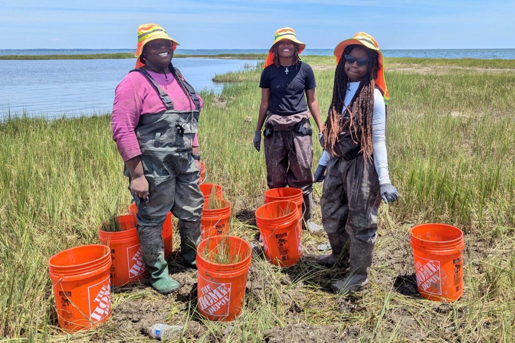
Developing Production Methods of Native Wetland Plants

Project Objectives

  • Compile protocols for field and lab cultivation methodologies of critical native wetland plant species. Initially, work will focus on Spartina alterniflora (Saltmarsh Cordgrass).
  • Act as consultants to Knott Alone – Hold Fast, Inc. in their endeavors to develop their plant production capabilities.
  • Refine and validate greenhouse/field culture methodologies for critical native wetland plants.
  • Determine the feasibility of sustainable harvesting of native grasses from natural wetland systems for plant production purposes.
  • Develop in vitro culture methodologies for Spartina alterniflora.
  • Explore the possibility of mutagenesis (the production of genetic mutations) as an avenue for the creation of new Spartina alterniflora varieties for production.

Anticipated Outcomes

  • As a result of two growing seasons propagating plants in lab, greenhouse, and field a substantial number of plants will be produced. These plants will be made available for restoration projects along the Elizabeth River or used for additional tests in the Norfolk State University greenhouse.
  • Collected seed will produce a stockpile which can be used by Knott Alone – Hold Fast, Inc. for production or NSU for expanded culture tests. It is unlikely these will be made widely available due to novel storage requirements to ensure viability.
Concrete Buttress Reef

Concrete-Based Shoreline Structures

Concrete Buttress Reef
FlexaMat
FlexaMat

COncrete Buttress Reefs

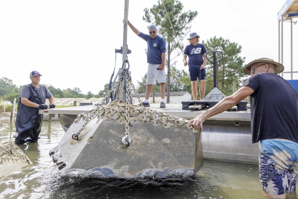
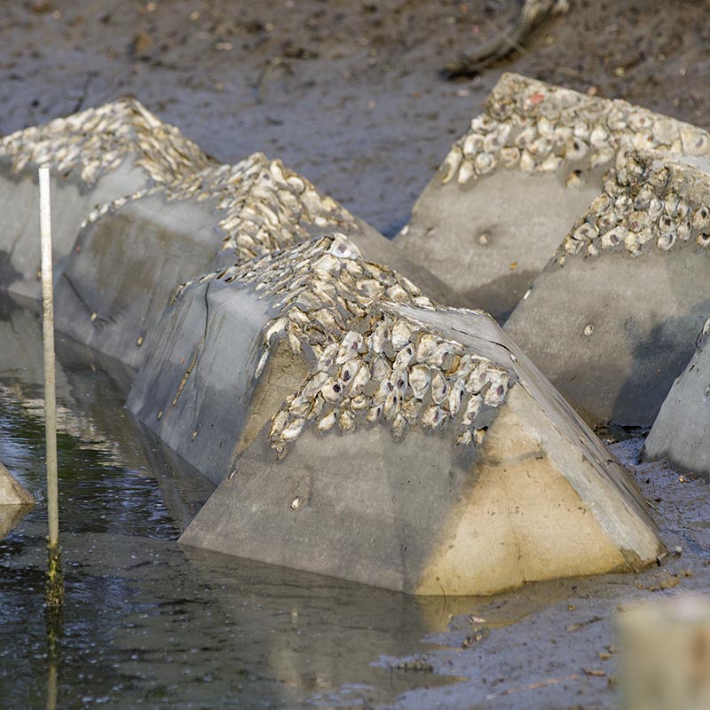
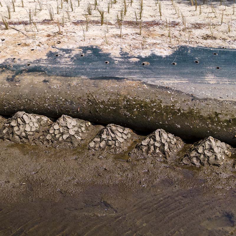
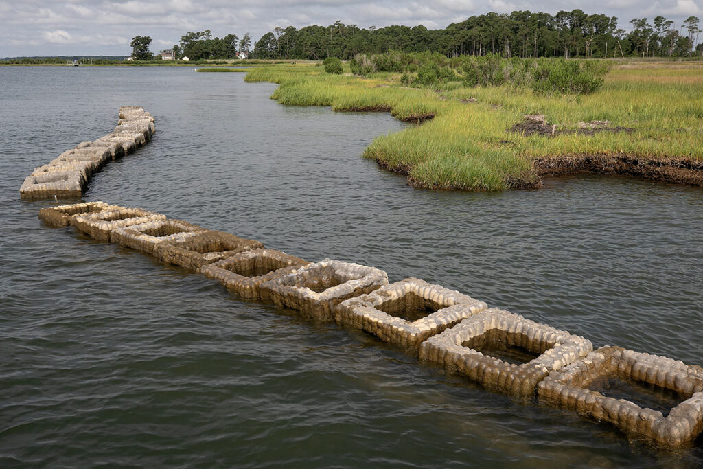
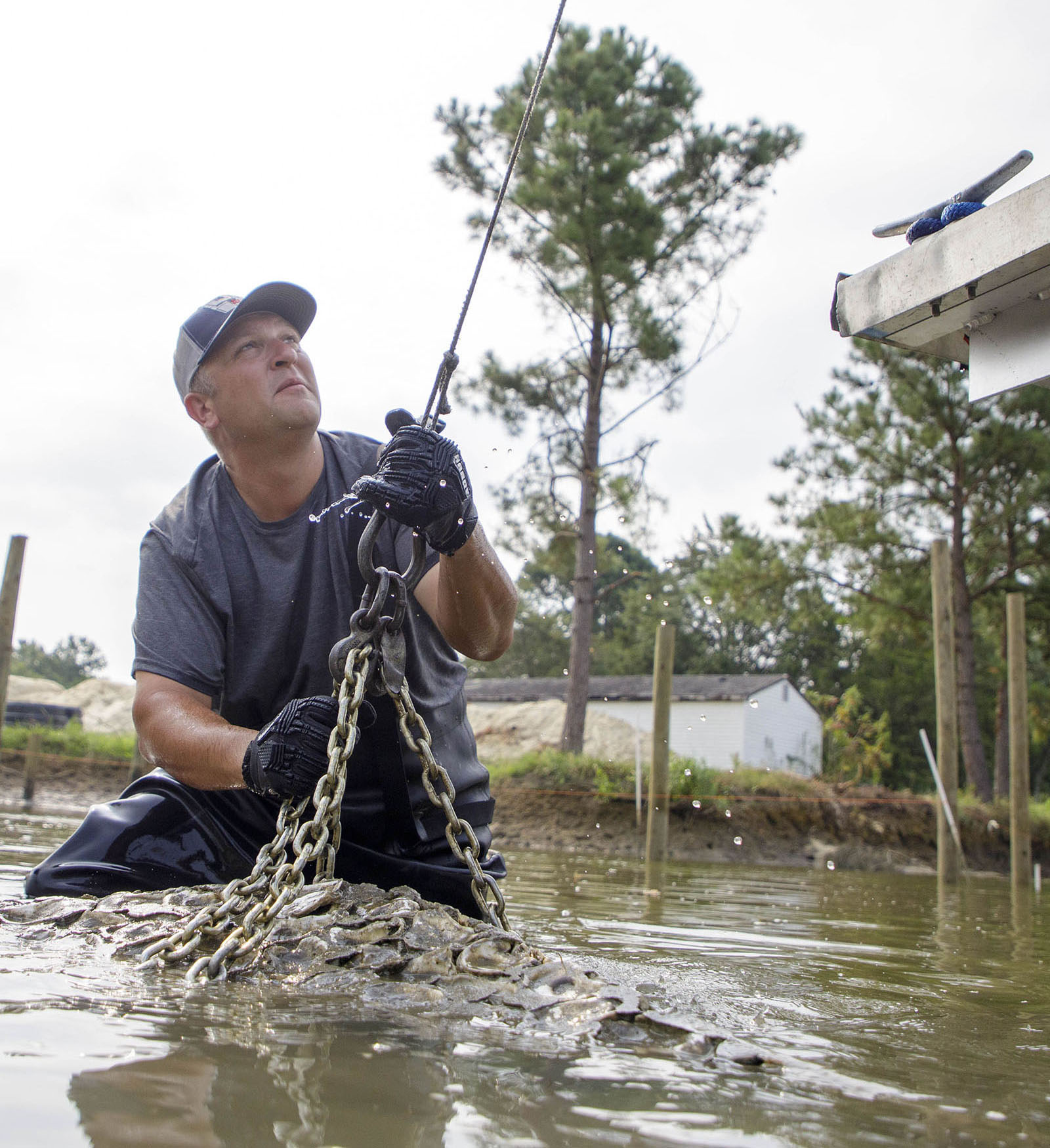
  • ReadyReef, Inc. produces living oyster reef sills that stabilize shorelines, attenuate wave energy, facilitate the restoration of native grasses, and enable the advanced recovery of oyster reef communities.
  • These concrete buttress reefs are often installed to effectively anchor GeoTubes and stabilize the slopes of shorelines in tandem with EnviroLok bags and FlexaMat.

Flexamat

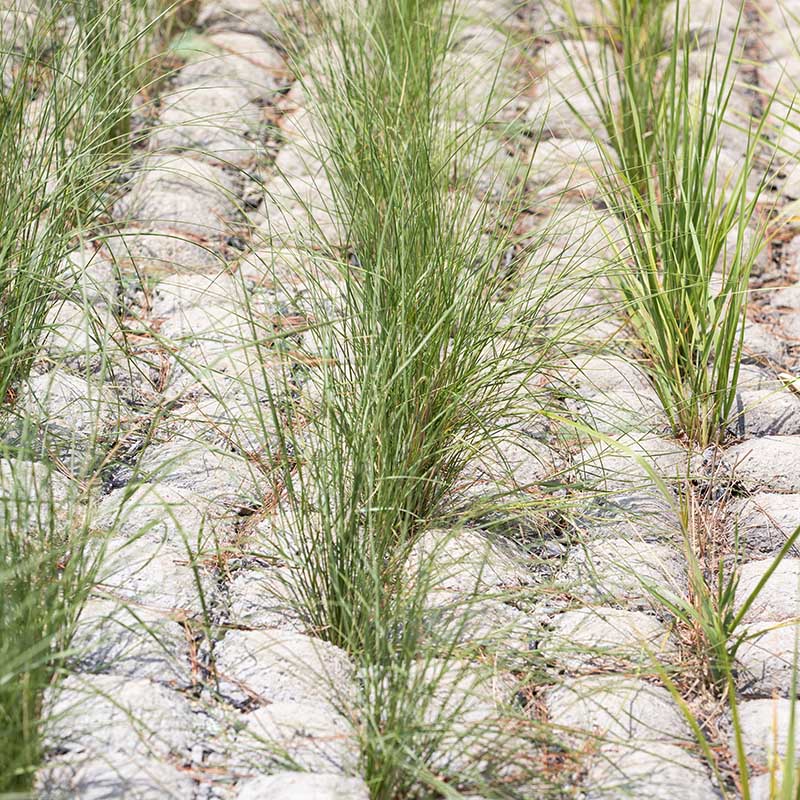
  • Flexamat is a vegetated concrete block mat utilized for stabilizing slopes, channels, low water crossings, inlet/outlet protection, and shorelines.
  • It consists of concrete blocks locked together and embedded into a high-strength geogrid. There is 1.5” of spacing between the blocks that give the mat flexibility and allows for optimal vegetation growth.

Geotextile Shoreline Stabilization

Dredge Sox
DredgeSox
EnviroLok Bags
EnviroLok Bags
GeoTubes
GeoTubes

DredgeSox

  • DredgeSOX Erosion Control is designed with a double layer of knitted polyethylene mesh that is filled by dredging shallow sediment into the containment unit.
  • When sediment is fine, polymer flocculants are used to bind the sediment which enables it to be retained within the DredgeSOX.

EnviroLok Bags

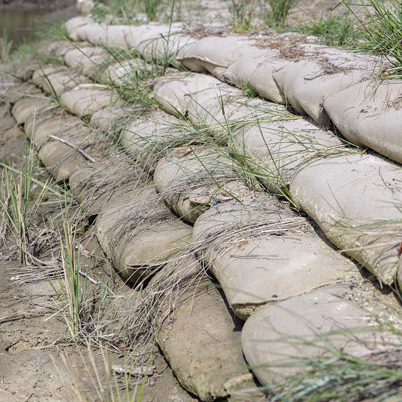
  • Envirolok is a fully-engineered geobag system designed to permanently stabilize slopes, waterways, and shorelines.
  • Envirolok combines the engineered strength of soil with the principles of plant ecology to deliver a sustainable, vegetative solution that will stand the test of time.
  • Envirolok’s resilience grows as the roots create a binding matrix through the bags and into the native soils behind.

GeoTubes

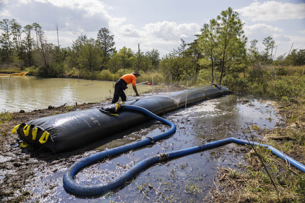
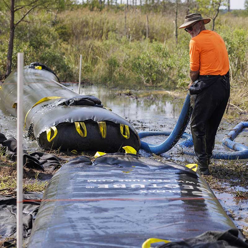
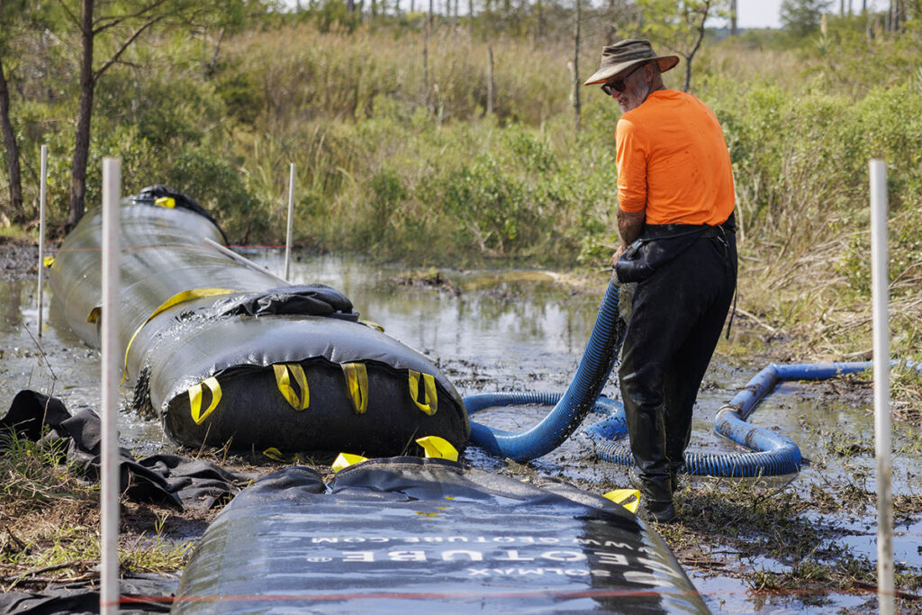
  • GeoTubes are engineered woven geotextile tubes for coastal erosion control, shoreline protection, and stabilization which are typically filled with onsite sands or other material pumped into the core for sustainable, soft armor protection.
  • The geotextile tube material is inert to biological degradation and resistant to naturally encountered chemicals, alkalis, and acids.
  • Hybrid GeoTubes can be planted with native grasses when installed on or adjacent to land.
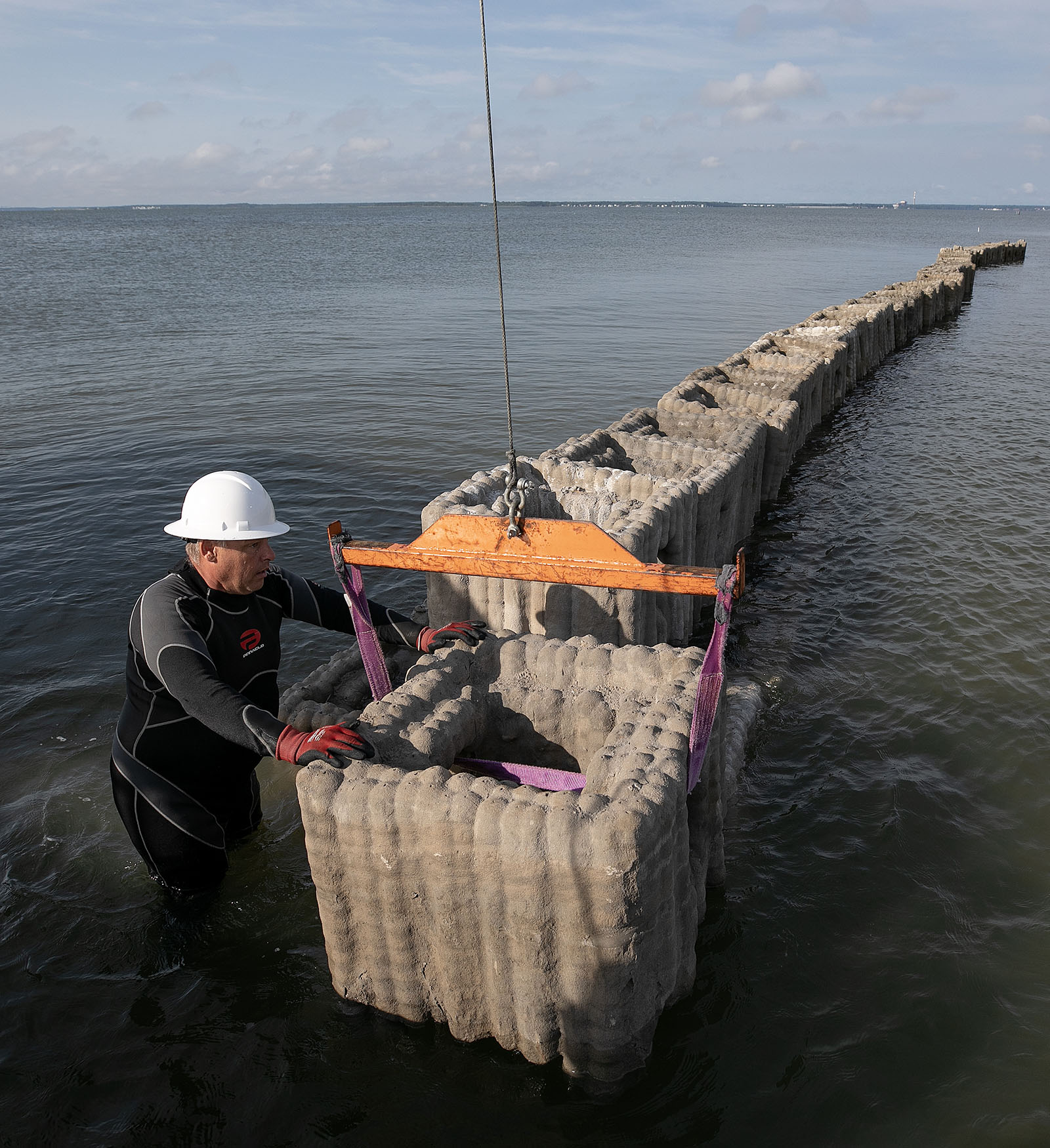
Reefs are being placed along the Guinea marsh to protect the islands from erosion Saturday August 5, 2023.
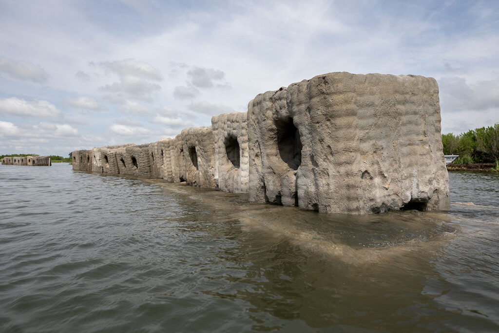
Natrx Exoform™ shoreline stabilization structures. Photo by Consociate Media.

Dredge Material Collection and Reuse

Biogenic Solutions Consulting - Use of Onsite Materials

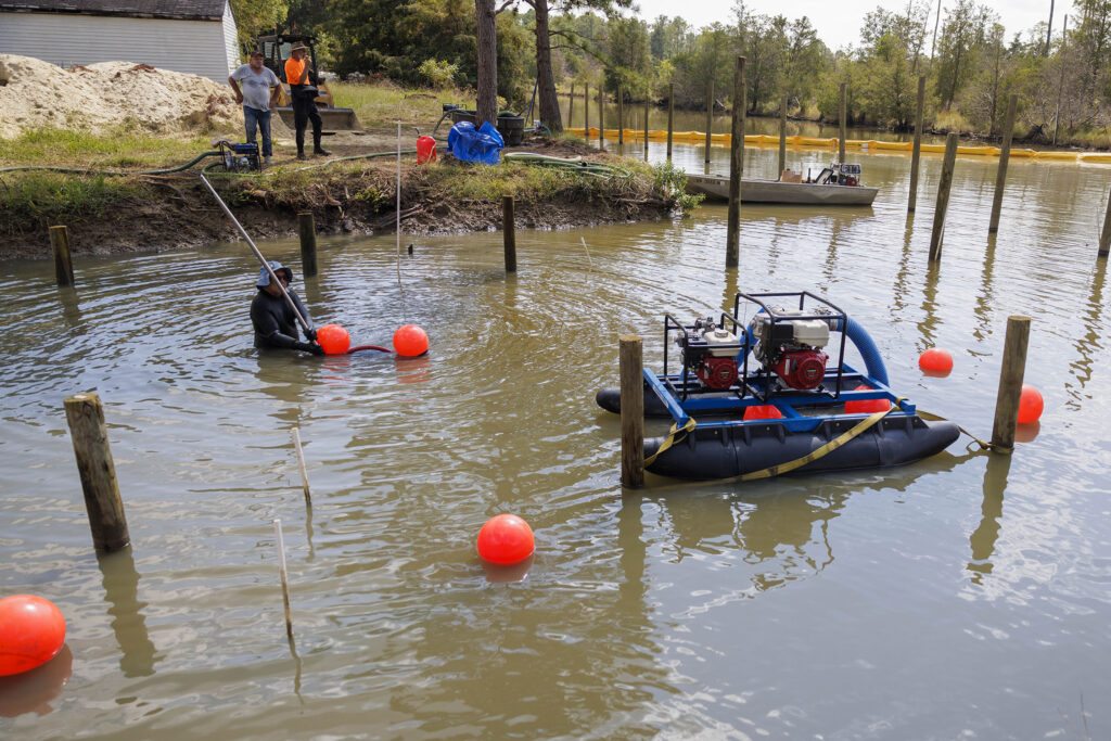
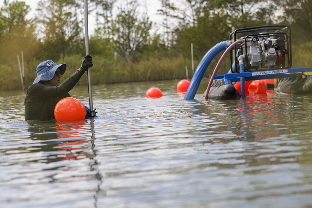
Both DredgeSox and GeoTube geotextile shoreline stabilization structures installed by Biogenic Solutions, Ready Reef, and Golden Oyster utilize shallow sediments and sands that were dredged onsite from the Whittaker Creek canal. 

Natrx - Repurposing Dredge Material

  • Successful Research: Natrx has tested and validated the use of dredged sediments as a partial cement replacement in its Exoform™ shoreline stabilization structures (shown above) through a process called calcination.
  • Scale of Operations: The amount of dredged clays in the Middle Peninsula far exceed the demand for producing Exoform™ structures — 100,000 cubic yards of dredged sediments would create enough armoring for 1,000 miles of shoreline.
  • Economic Impact: The beneficial use of dredged sediments could have enormous primary economic benefits in rural areas including reduced sediment disposal costs, job creation, and lower material costs for construction and resilience activities.
Wave monitoring sensor

George Mason University - Old Dominion University

Computational Modeling and Field Observations of Waves and Turbidity

Research Tasks

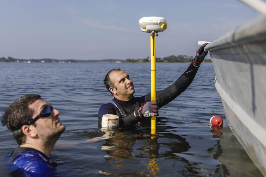
  • Evaluate the performance of innovative coastal protection strategies by measuring boat wakes and their attenuation across the shoreline with different vegetation densities and stretches protected by nature-based solutions using ODU and GMU wave and hydrodynamic sensors.
  • Determine how nature-based solutions help address shoreline erosion under a range of conditions including high frequency wave events and extreme wave events.
  • Evaluate the performance of innovative nature-based solutions for shoreline protection under a range of future climate conditions using computational modeling.

Anticipated Outcomes

  • Performance evaluation of innovative nature-based solutions based on field scale prototypes and environmental measurements.
  • Enhanced understanding of how boat wakes and wind waves are attenuated by these Types of nature-based solutions.
  • Enhanced understanding of how nature-based solutions help address shoreline erosion under a range of conditions including high-frequency wave events and extreme wave events.
  • Performance evaluation of innovative nature-based solutions for shoreline protection under a range of future climate conditions.

Triangle Environmental Health Initiative

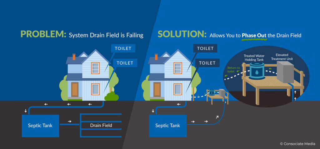
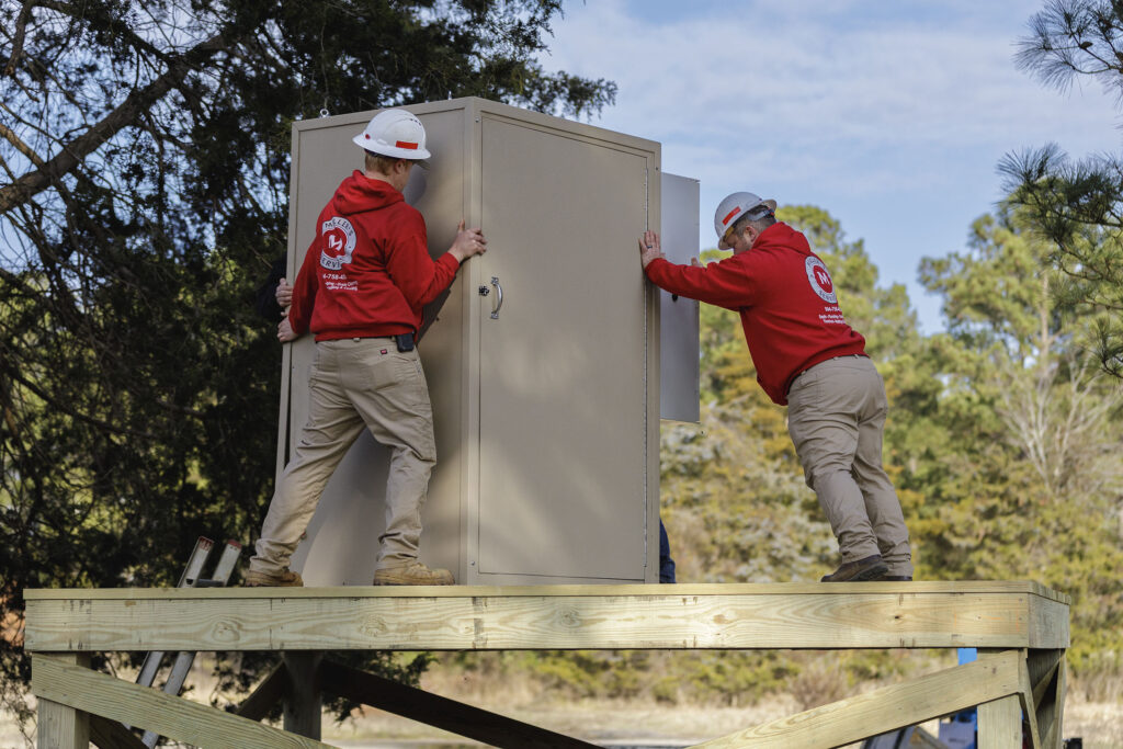
Triangle Environmental Health Initiative (TE) is collaborating with partners in Virginia’s Middle Peninsula to implement onsite wastewater treatment systems for non-potable reuse in rural communities. These systems aim to provide flood-resilient septage systems and reduce strain on well water.

In addition to funding and mentorship, TE receives a full value chain of services from the community, including access to physical infrastructure as a living laboratory to demonstrate and refine their products. This novel, cross-sector collaboration has turned climate resilience into an economic driver for the region.

Triangle Environmental has been developing Water, Sanitation and Hygiene (WaSH) technologies for use worldwide from its North Carolina headquarters since 2016. Their products are focused on onsite wastewater treatment and resource recovery, and their consulting services are geared toward the development of sustainable WaSH products, services, and ecosystems for resource-constrained communities internationally and in the U.S.

Photo Captions:

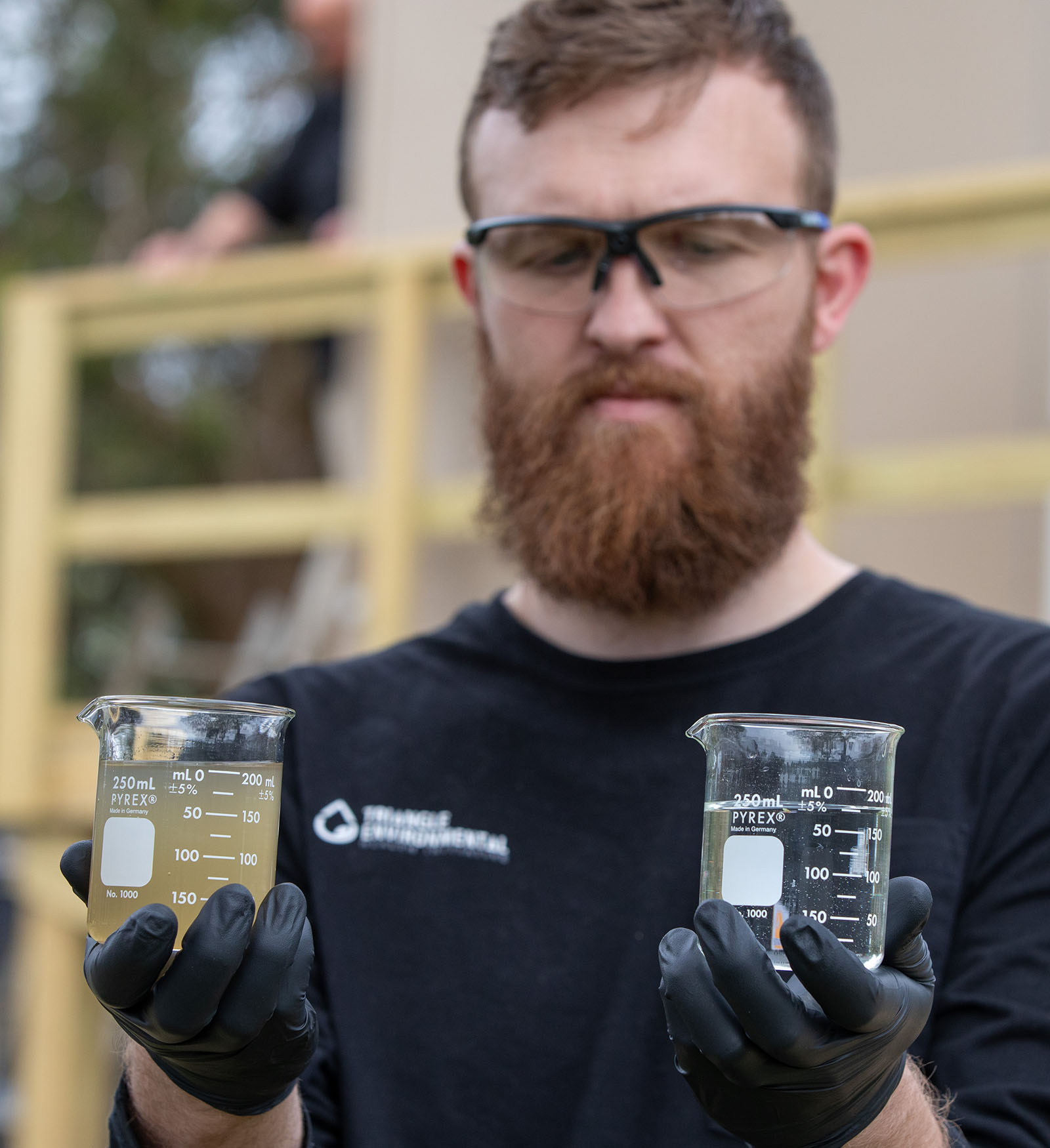
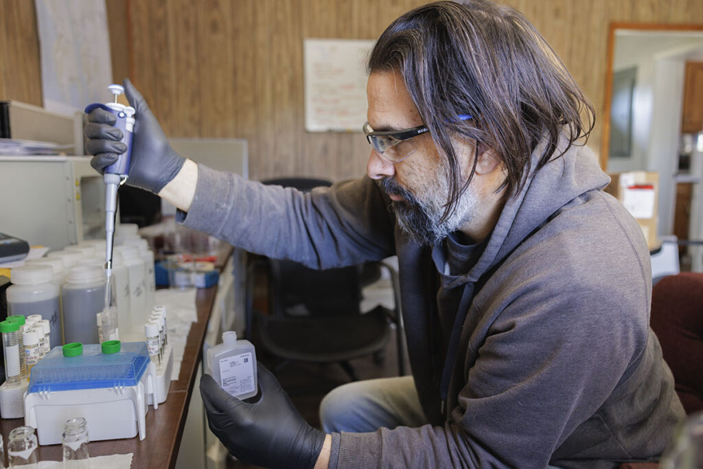
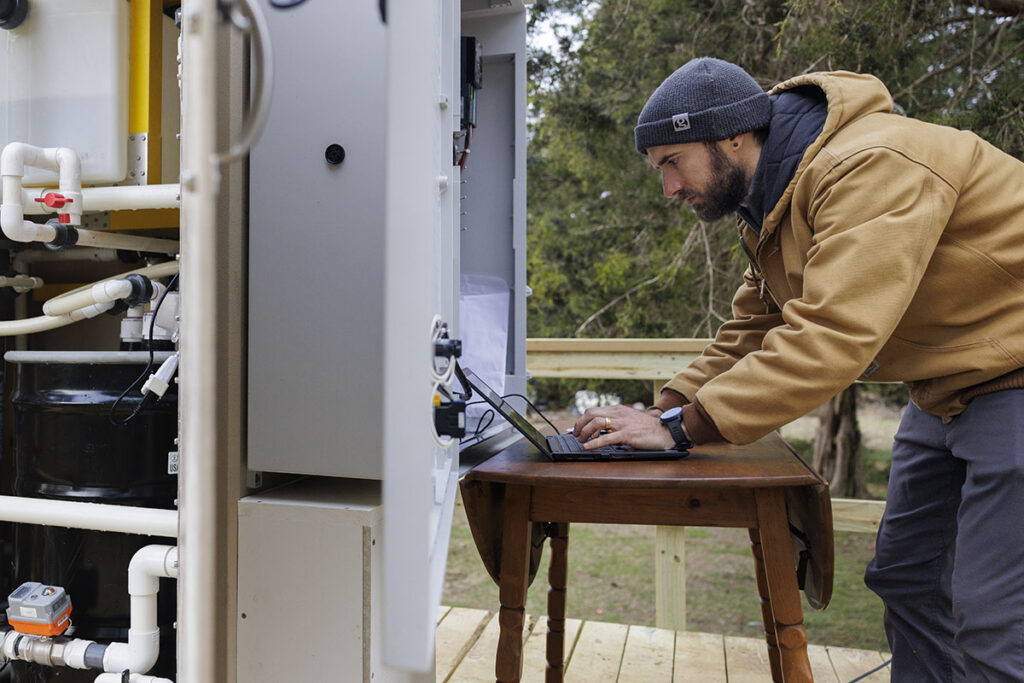
Far left: Founder and Principal Tate Rogers with water samples before and after the filtration process. Top Center: Nick Barnes, a veteran in the Knott Alone – Hold Fast program, tests samples from the treatment system. Bottom Center: Dr. Aaron Forbis-Stokes, Research and Development Manager, monitors the treatment system during testing.

Top: Founder and Principal Tate Rogers with water samples before and after the filtration process. Middle: Nick Barnes, a veteran in the Knott Alone – Hold Fast program, tests samples from the treatment system. Bottom: Dr. Aaron Forbis-Stokes, Research and Development Manager, monitors the treatment system during testing.

Reefs are being placed along the Guinea marsh to protect the islands from erosion Saturday August 5, 2023.

Natrx Adaptive Infrastructure

Transforming Dredged Material into Sustainable Solutions with Natrx

Natrx is paving the way for a more sustainable future by turning dredged material waste into a key component for eco-friendly construction. The climate technology company has developed an innovative technology that uses dredged material as a partial replacement for cement in concrete. This process involves heating the dredged material to produce calcined clay, which can substitute up to 70% of the cement in concrete production. This groundbreaking approach offers numerous benefits:

  • Environmental Impact: Instead of sending dredged materials to landfills, Natrx repurposes them, reducing waste and making it easier for dredging projects to gain approval. The substitution of traditional cement with calcined clay significantly reduces greenhouse gas emissions, making concrete production more environmentally friendly.
  • Cost Savings: By converting waste into a valuable product, Natrx’s new approach has the potential to lower disposal costs for dredging projects by about 50%, saving $2 million to $3.8 million annually. Over 20 years, this adds up to $20 million to $76 million in savings.

Photo Captions:

The Middle Peninsula Planning District Commission initiated a construction project to install a nature-based shoreline protection and habitat restoration solution using Natrx ExoformTM structures along Hog Island in Gloucester County, Virginia which historically has experienced severe erosion. The project aims to protect and enhance maritime habitat for shorebirds and other species, restore oyster populations, and reduce erosion and sedimentation into the Chesapeake Bay. Natrx is exploring the possibility of replacing up to 70% of the cement in these types of structures with dredge materials removed from the Bay and surrounding tributaries. Photos by Consociate Media.

Advanced Waste Collection and Treatment

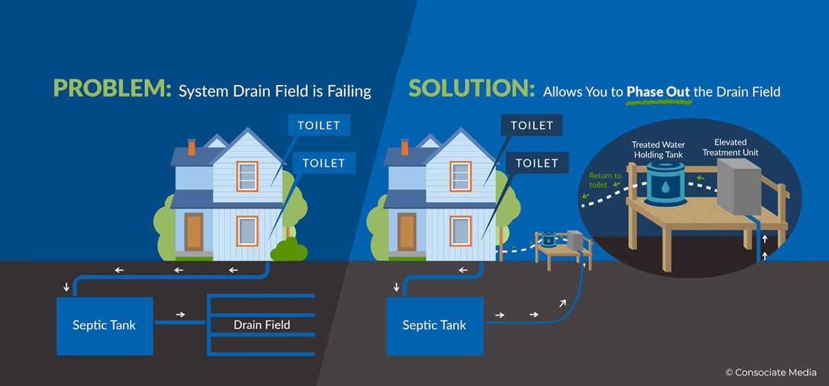
This pilot project is more than just an innovation, it’s a beacon of hope for rural coastal homes and businesses. Here’s why:

Overcoming Drainfield Failure: By eliminating the need for a traditional drainfield, this system is a game-changer for areas where they are failing.

Designed for Coastal Challenges: It’s specifically designed to handle the unique challenges of coastal areas – rising sea levels, and more frequent and intense rainfalls.

Safeguarding Homes and Businesses: This system offers a reliable and sustainable  wastewater treatment option, which is crucial for the livelihood and safety of these communities.

THE INNOVATIVE APPROACH

Advanced Waste Collection and Treatment: The system collects wastewater like usual but then treats it in a vertically elevated unit (typically on pilings), ensuring it’s not affected by flooding.

Safe Discharge: Wastewater is treated to a high quality, meeting state standards to discharge away from the property.

Resilient Water Reuse: Alternatively, after treatment, water is stored and reused in a way that’s safe and eco-friendly (irrigation, flushing toilets, etc.), a big plus for areas where water resources can be strained.

Old Dominion University

Best Practices for Planting Desired Coastal Vegetation Species

Research Tasks

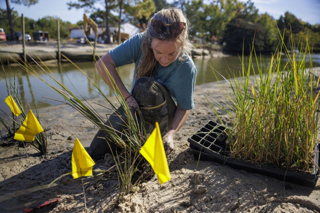
  • Compare planting strategies (standard spacing of transplants vs. high-density spacing of transplants vs. donor-marsh transplants) in terms of plant survival and marsh expansion over at least one growing season.
  • Examine sustainability of marsh transplant removal intensities in donor marsh locations to determine best practices for obtaining marsh transplant materials while minimizing damages to existing marsh.
  • Monitoring of plant survival, vegetation density, and species richness both pre- and post-construction, and the following growing season.

Anticipated Outcomes

The anticipated outcomes from these tasks include data on plant survival, lateral expansion (area of vegetated cover), plant performance (stem density, height, overall plant vigor), and below-ground biomass production that can be used to assess the impact of planting strategy on marsh revegetation, turbidity and wave attenuation. Transplant donor marsh locations will be monitored for recovery of above- and below-ground parameters (below-ground biomass, stem density, sediment physiochemistry, elevation) to determine the suitability for the practice of marsh transplanting and the speed of reference marsh recovery.

Workers from Biogenics Solutions, Ready Reef, and Golden Oyster install oyster castles in a channel of Whittaker Creek in Gloucester, Virginia on Aug 15, 2023.

Biogenic Solutions Consulting

Biogenic Solutions is a leading provider of consulting support in restoration, mitigation, and biogenic shoreline reef management. Dr. Russell Burke is the chief consultant and has been providing advisory support to federal, state and local government agencies, as well as non-profit organizations, private companies, and individual homeowners for more than five years. Dr. Burke earned his Bachelors of Science in Marine Science and Environmental Science from Rider University, and a Ph.D. in Marine Science from the College of William & Mary’s School of Marine Science at the Virginia Institute of Marine Science. Currently, he is a full-time professor at Christopher Newport University.

With a career commitment to Virginia’s Chesapeake Bay, Biogenic Solutions Consulting has invested years into biogenic breakwater reef technology. Expertise in oyster reef restoration and living shorelines has enabled them to offer novel, biogenic solutions to private homeowners, commercial waterfront properties, and municipalities seeking more natural, sustainable approaches to shoreline protection and oyster reef development. Their systems provide a reprieve from erosive wave energy, accelerate oyster reef community development, and allow for customization suitable to address both physical and budgetary constraints specific to each project site.

Photo Captions:

Far Left: Dr. Russell Burke, Chief Consultant, installs a concrete buttress reef. Top Center: Ready Reef’s Chris Davis filling GeoTubes with dredge materials from the Whittaker Creek canal. Bottom Center: A small vacuum dredging unit was used to collect bottom sediments and pump them into the geotextile shoreline stabilization structures.

Top: Dr. Russell Burke, Chief Consultant, installs a concrete buttress reef. Middle: Ready Reef’s Chris Davis filling GeoTubes with dredge materials from the Whittaker Creek canal. Bottom: A small vacuum dredging unit was used to collect bottom sediments and pump them into the geotextile shoreline stabilization structures.